|
Year
and Month |
October,
2010 |
|
Number
of Days |
Second
day of the 3days journey |
|
Crew |
5
(25 to 38 years age). |
|
Accommodation |
Uva
Management Training Institute@ Passara |
|
Transport |
Jeep
(CJ5) |
|
Activities |
Photography,
Waterfall hunting, Hiking |
|
Weather |
sunny |
|
Route |
Passara
-> 4th Mile post -> Wewassa Estate (Upper Division) -> Namunukula
Peaks Nos. 9 to 5 -> Deyanegalla Division -> Glen Alpin Division -> |
|
Tips,
Notes and Special remarks |
|
|
Author |
Viraj |
The lost
aim at Namunukula.
All of us were got up while the sun emitted his first rays to Passara. We were willing to explore Namunukula - the giant raised to catch the sky in front of us.
Existence
of nine peaks was caused to name the range as Namunu- Kula. It was the 12th
highest mountain in SL. The highest peak out of 9 was climbed by many hikers
each year; but from
 |
|
Namunukula
range wrapped with mist |
Since
we were gone misunderstand with false information, no local guide was arranged
for the hike. The false information received last night was that existence of a
clear trail to the top; starting with a stepped path from the main road. As a
result we got mad when we met the canteen keeper at our breakfast. (We already
got to know him through a personal contact). He explained us the necessity of
an experienced local guide for a safe & successful hike at Namunukula from Passsara
side.
 |
|
Uva Management Training Institute@ Passara |
 |
|
Namunukula
- the giant raised to catch the sky in front of us |
So we
gave a try to hire an experienced guide, but failed. Some had engaged with
other works & some refused saying not sufficient time remained to complete
the journey before the dusk. As per them, the hike should be started at the
dawn. But finally a recondite character was agreed to guide us. As per him, he
had been to the hilltop more than 12 times. We were much happy, but it was too late
when we realized the hidden agenda of the guide.
 |
|
URY tea factory met on our walk of 3km
along the main road |
It was almost 9.00 am when we left from
the institute. The guide took us along the main road towards Badulla for more
than 3 km which was a significant descending. Further; he asked us to empty our
excess water bottles so that to reduce the weight & could fill them up from
water sources available on our way to the summit.
 |
|
Our walk of 3km along the main road |
Since the group of hikers was a strange site to
the villagers, some of them were daring enough to ask where we were going.
Since they were answered that we were heading Namunukula, they impressed two
things. One was the shorter route was started from 5th mile post (the
Institution we started the journey was located at the 6th Miles post)
and the other was that we were too late to complete the journey. But our guide
was taking us to the 4th mile post, as a deaf.
 |
|
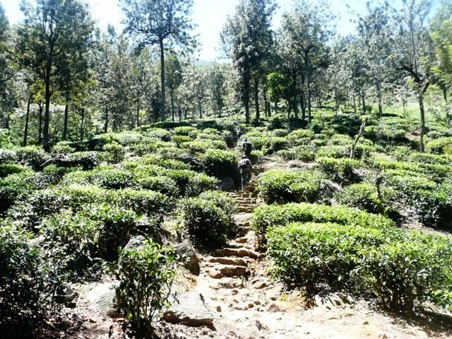
Just
after the 141/4th culvert of A5 hi-way, (commonly known as 4th
mile post) we found a trail head |
Just after the 141/4th culvert
of A5 hi-way, (commonly known as 4th mile post) we found a
trail head. The trail was a high ascend & burnt a significant amount of our
energy within the first 500 meters. Passing some barriers such as slippery
rocks at almost dried water ways and walking along an edge of a moderate cliff
in a forest-like non cultivated area; we came in to a gravel road (estate road).
The bendy road was leading to the upper divisions of the tea Estate. We used
rock paved drains at the tea estate as short cuts and proceeded without grumble. Having
climbing nearly an hour, we reached a 3 way junction at the estate road. The
uphill was towards the upper division of Wewassa plantation, where we should
proceed. But the guide was kept silent on the destination of the downhill road
when we inquired.
 |
|
The trail was a high ascend &
burnt a significant amount of our energy within the first 500 meters |
Then
a tractor of the estate was arrived & since it was driven uphill for
collecting tea leaves, we were given a lift for nearly a kilometer with narrow,
steep & bendy estate road.
 |
|
Capturing |
 |
|
Ascending |
After
having another half a kilometer climb, we reached another three way junction;
located at a gap. There was a Hindu shrine. From that point also, we took the
road lead to uphill. (Actually the other route was also descending towards 3rd
Mile post)
 |
|
Continue |
 |
|
There
was a Hindu shrine |
 |
|
We
took the road lead to uphill. (Actually the other route was also descending
towards 3rd Mile post) |
There
was an important thing even our guide did not mentioned us. That was the last
(the 9th) peak of the range was just few meters above the said
junction. Providing evidence for the same; we could observe the Uva Management
Training Institute through the gap of 9th and 8th peaks;
within the first 100m uphill from the said junction.
 |
|
we
could observe the Uva Management Training Institute through the gap of 9th
and 8th peaks |
 |
|
Green |
Again
and again using rock paved drains at the tea estate as short-cuts; we reached
the upper most part of the tea estate while our water bottles were getting
empty. Even a thin water source could fulfill our requirement since we were
armed with water purification tablets. But no water could find yet. May be; due
to the dry weather condition applied for the area those days.
 |
|
Heaven
? |
 |
|
Wow |
How
ever we entered in to the forest patch which covered the upper most parts of
the mountain, with half a liter of water for all. We had to limit consuming
water to a dirnk for each, in a nominated moment/round.
 |
|
We
entered in to the forest patch |
 |
|
We
were moving through a thick bamboo forest |
At
first we entered in to mixed forest. The trail became steeper & hard in
each step. In the next moment we were moving through a thick bamboo forest. The
trail was disappeared and we stick in dead ends several times. Our guide was
also confused and as the first time we were distrusted on the knowledge of the guide. We
were loss our way in the thick jungle so that one could not see the sky, and
wander for nearly 45 minutes until get in to a proper trail.
 |
|
We
lost our way |
The
trail led to the summit of 7th peak which was full of dung of deadly
wild buffalos.
We
were much tired, hungry & thirsty; badly wanted water. But there were no
sign of a water source. So we proceed further towards the 6th.
 |
|
the
summit of 6th peak |
At
the 6th, we got the same result and no water. We had no option
unless proceeding forward. This time the trail was laid along the margin/
perimeter of a tea plantation at the opposite side of the range we started our
journey that day.
 |
|
This
time the trail was laid along the margin/ perimeter of a tea plantation |
Though
our aim was to explore the whole 9 peaks, we had to re-consider the same with
the limited time available, when we reached the 5th peak. Since we
were not armed with suitable light sources, it was impossible to return through
the thick forest patches in the night.
 |
|
We
reached the 5th peak |
 |
|
We
decided to give-up the exploration for the day. |
We
had no water and still moved forward with the hope of water source. Since we
had water purification tablets, even a little source could fulfill our
requirement. After the 5th peak we observed some signs of
civilization in the base of the valley. There were some shelters with a Kovil.
That was a good sign indeed. With the lost confidence on our guide; we decided
to give-up the exploration for the day. We climbed down searching for water.
 |
|
There
were some shelters with a Kovil |
 |
|
signs
of civilization |
When
we climb down to the village, we could observe a tiny waterfall in the other
bank of the deep valley. At the first sight we realized that she would break
all the records if she gained a bit more in volume. Even in such a drought, she
was smiling with the evening sun. That little beauty was known as “Nilini Fall”
& left a little delectation to the disappointed hearts.
 |
|
Nade-gura |
 |
|
That
little beauty was known as “Nilini Fall” & left a little delectation to
the disappointed hearts |
 |
|
We
had climbed down to the opposite side of the range |
We
had climbed down to the opposite side of the range. Our guide was also confused
on directions & he was busy in verifying the same with Tamil villagers.
With a trail of 5km showed by villagers, we climbed down to a bus driven road.
It was the main road from Badulla to Spring-valley. When we were waiting for a
bus, we were given a lift by a truck of the Telicom project. Afterwards having
walking another kilometer more, we reached Badulla-Passara main road and got in
to a bus for Passara. It was almost 9.00pm when we reached our hostel. We had
walked nearly 13 km in a hard Terrain while
the total journey was 30 km. for the
day.
 |
|
.With
a trail of another 5km showed by villagers, we climbed down to a bus driven
road |
 |
|
Last
sunrays to |


No comments:
Post a Comment